Saturday, March 26, 2016

March 26, 2016 Rest Day in Pohora


We are living the life of luxury here at the Ratanui Lodge in Pohara.  Pohara is a beach resort town along Golden Bay.

Being a rest day the schedule was to relax all day.  Heavy on the low key.   Agnes and I slept until almost 8:30 Am this morning which was quite a change from the up at 6:45 am.  We almost missed the continental breakfast which was served until 9:00.  However lying in the big beautiful bed with the wonderful fine linens was so luxurious we just didn’t want to get up.

After breakfast Agnes and Lynn went up the road to see some art galleries in Collingwood and Jos, Tom and Amy and myself drove into Takaka.   Tom and Amy wanted to do some gift shopping and Jos and I just strolled the little tourist town.  We wandered into the local museum which told the history of Golden Bay.  It was very interesting as it described the early years of the gold rush, the early farming and logging and there was even a iron ore mining operation which not only mined ore but smelted it and poured cast iron fittings and pipe.  

After the museum we meetup with Tom and Amy, who had been successful in their shopping and headed off to see Te Waikoropupu Springs (Pupu Springs).   Te Waikoropupu Springs are known for their unusual clarity and have visibility to 63.0 meters which is compred to distilled water which would have visibility to 85 meters.  These springs are of spiritual importance to the Maori as the home of one of the female legends.  The springs are huge and have very large river flowing out of them and the water is unbelievably clear.   A picture taken with my water proof camera shows how clear the water is.

During the entire trip we have heard about the silver fern. New Zealand has been looking to get a new flag and were proposing to put it on the flag (however the referendum has been defeated).  We have seen millions of ferns of every size and description but no silver ferns.  Tom and I have started saying that it must be a mythical plant. Today at Te Waikoropupu we found some silver ferns.

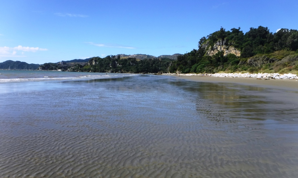
After a picnic lunch Agnes and I and Jos and Lynn went for a stroll along the beach.  It was so beautiful and serene.  Miles of sand and lapping waves.  Sun streaming down. 

Jos had arranged for a special celebration supper in the hotel.  It featured lots of New Zealand specialties the center piece of which was rack of lamb.  WOW is all there is to say.  Then at rider meeting Jos had rider awards for everyone. 

Terry 

Friday, March 25, 2016

March 25, 2016 Motueka to Farewell Spit


Today was the final day of cycling for the tour but certainly not the end of the New Zealand adventure.  And a great final cycling day it was.  We started out from our motel in downtown Motueka and had a nice flat 9 kms ride to the base of the Takaka Hill where the fun really started.   

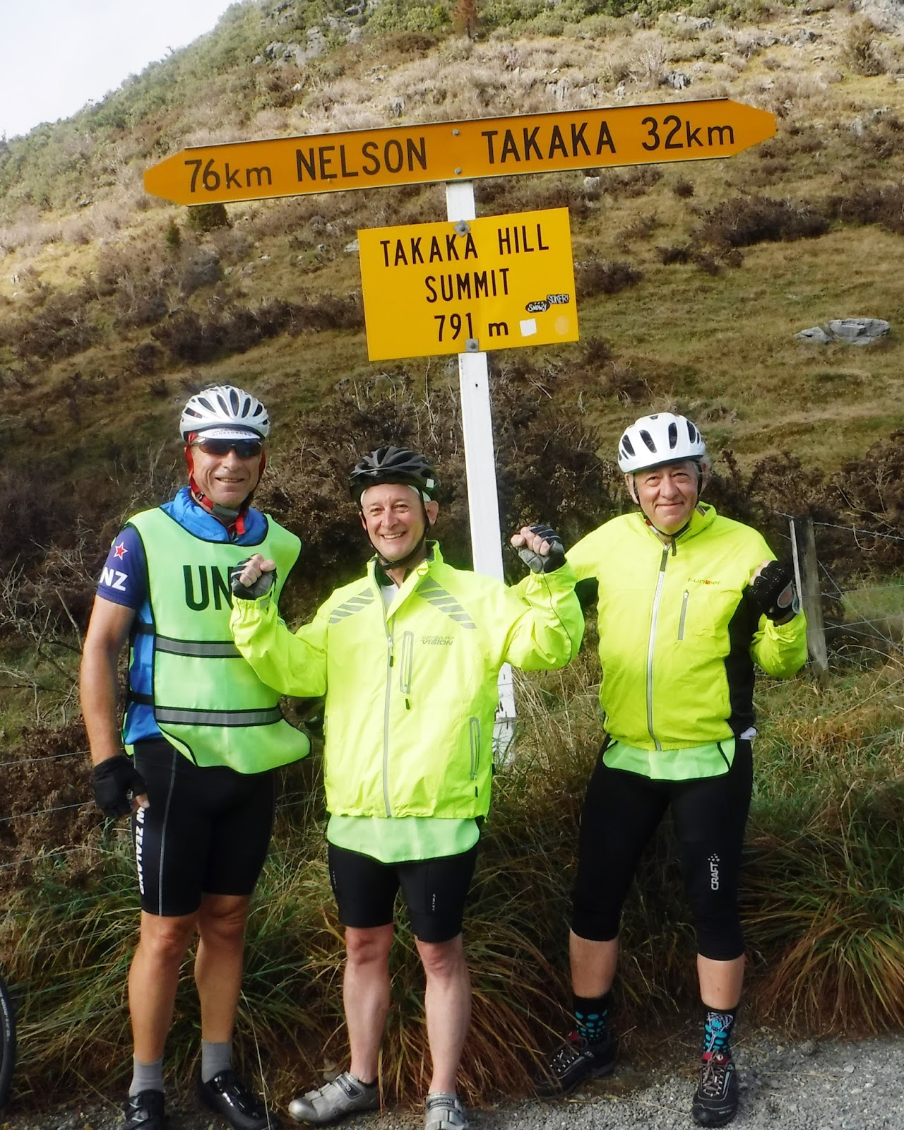
So let me back up and give you some facts on the Takaka Hill.  You are starting out from sea level and climbing to 791m in 16.5 kms.  This gives you an average grade up the east side of 4.7%.   However the first 3 kms are close to 11% and then the grade slowly backs off so that the last few kms have almost no grade at all.  Here is a link to the Takaka Hill on “World’s Most Dangerous Roads”:  http://www.dangerousroads.org/australia-and-oceania/new-zealand/1085-takaka-hill-new-zealand.html  The east side climb which we did compares to the Tour de France  col of Alp d;Huez in that it is 13.2 kms and has a climb of 1071 m.  The Passo Dello Stelvio is 21.5 kms with an accent of 1533 m.  So Takaka Hill is not quite the same kind of climbs.  In comparison to the Yarnell Hill from Congress up to Yarnell is 14.2 kms with an accent of 568 meters or 4.0%.  It is similar just 50% more.  Here is the google map link: https://goo.gl/maps/uDHKvNoR99J2

The views from the top were spectacular.  On the one side was looking down toward Motueka and on the other you look down on Golden Bay.  Looking east you can see the town of Motueka on the ocean and you say wow did I really climb up here.  Looking west you can see all the way across Golden Bay and out to Farewell Spit which at this point is still 70 kms away. 

The west side is a scary 10 kms down a narrow twisting road.  I am not really fast on descents and once the I get to around 60-70 kms I am leaning on the brakes.   My brakes were on full.

After the big decent we had a 70 kms ride across some low rollers out to Farewell Spit which is the most northerly point of the south Island of New Zealand.

Farewell Spit is this huge sand bar which runs for miles out into the ocean.  It was a great place to complete our 1240 kms tour from the very furthest south point on the south island to the most northerly point.  Lots of pictures were taken and congratulations handed out.  Bottles of champagne marked this great bike adventure.  It could not have been a finer day with blue sky and temperatures in the 20’s.

However there are still lots of adventures left on this trip as we make our way onto the North Island.  WOW is all there is to say.

Terry 

Thursday, March 24, 2016

March 24, 2016 Murchison to Motueka


This morning when we got up there was over 3 inches of rain in the rain gauge which Agnes had but out the day before at 4:15Pm.  Most of the night it had bucketed down but it stopped around 4:00 Am to 5:00Am.  Close enough to say that 3 inches fell in 12 hours.  We were pretty pumped that we were not going to get any rain for today’s rain.  By 8:00 AM when we were ready to ride it was back to bucketing down.  So we put on the full dress rain gear, from shower caps to rain booties. 

The ride to day was a steady 1% grad for the first 45 kms so we started off grinding a way in the pouring rain.  Fortunately the wind which had been forecast to be 10-15 kms in our faces had failed to show up and we made good time.   By 9:30 the rain had disapated and the sun was out and it was starting to get to be quite warm so we stopped an pulled off all of the rain gear.  I kept the booties on as the road was quite wet and I didn’t want my shoes to get soaked. 

At the 45 kms mark we hit the big hill which was 3.5 kms of 9-12%.  It was a big hill and the sun was just baking us.  I was totally panting by the time I got to the top.  There was an old Subaru with the hood up pouring steam out and I sure felt sympathy for the old car.   The view was worth the climb and now we had 80.5 kms of downhill.   I believe we were going from 620 m down to sea level.  The first 15 kms was pretty steep and winding road. I got behind a big semi-truck pulling large tanks of milk and had to ride my brakes to keep from running into him. 

After the really steep section there was a lot of rolling downhill with a lot of sheep farms on both sides of the road.   It was great fun barking at the sheep and watching them scatter.  This one field must have had a thousand sheep and they were all on the run.  There is a saying down here called “going WOFing” which is “Working On Farm”.  I think it means barking at the sheep. 

We stopped at a little café for a coffee.  Tom says “You know we have not had any flats”.  I said “bad Juju saying that” We rolled out to the café and 50 meters down the road Tom has a flat. 

Further down the road we crossed the Motueka River which was in total flood.  There were huge trees going down the river. Jos says he never seen the river so high.   Then on the river road which according to Earnie-pedia is the most beautiful ride in all of New Zealand there were two sections where creeks had flooded across the road.   There are several places where towns have been flooded by the river.

The road to Franz Joseph Glacier where we were a few days ago it closed due to flooding.   A state of emergency has been declared in Franz Joseph where 149 mm fell in 4 hr.  Watching the flooding on TV is hard to believe this beautiful town is washed away.   I cannot believe how lucky we are to have lost only 0.5 days out of all of this rain. 

This was an absolutely astoundingly beautiful day of riding.  The sun was out and the scenery was in full bloom.  Grinding away in the rain turned into flying along in the warm sun.   I think that we covered 129 kms and had a climb of 929 m.  Here is a link: https://goo.gl/maps/ceNab2H1hK


Terry Bin Barkin

PS:  Tomorrow we ride where no Earnie has ridden.  

Tuesday, March 22, 2016

March 23, 2016 Charlston to Murchison


The weather forecast for today was for heavy rains with up to 200 mm in the next 24 hours and winds averaging 30 kms out of the NE and gusting to 50 kms.  The ride called for 110 kms and 1310 m climb headed almost due NE.  It was going to be a challenging day even without the weather.  The wind alone made it an impossible day and rain reduced the visibility to almost zero making a really totally unsafe.

However we were not going to just sag down to the next stop.  The wind and rain were coming over the mountains from the NE and through the pass towards the west coast.  So we got up early and rode 30 kms up to Westport.  The wind was almost zero when we left the motel at 8:15 AM but by the time we got to Westport it was blowing pretty hard.  So we turned west and rode out to Foulwind Point a further 16 kms.  Sailing along with the wind was great fun.  We jumped off out bikes and walked out to the lighthouse at Foulwind Point.  It was an important navigational point in the early days of navigation between Australia and New Zealand.  After the little walk to the lighthouse we rode a further 5 kms down to a seal colony.  We walked out to see the seals on rocks and just as we got back to the van the rain started to bucket down.  Not the big ride but at least we did get 51 kms in.  

We loaded the bikes and headed into Westport for lunch.  Agnes, Jos and I went into the Westport “Coal City” museum and Tom and Amy went shopping.  The museum was very interesting and detailed the coal industry along the west coast on New Zealand.   The industry started in the 1860’s and continued through the 1970’s when the last of the big mines shut down.  Low prices and declining production ended coal mining on the west coast.  There is still lots of coal to be mined and it is all high quality bituminous coal but low prices and low demand prevent further mining. 

After lunch we sagged the down the 70 kms to Murchison.  The canyon ride looked really beautiful or at least what could be seen.  It is a real shame we could not ride it.  The only thing is to come back and again. 

Here is a link to the ride:   https://goo.gl/maps/t1GeNGn3ENo

Weather forecast for the next to week is sun – Yahoo


March 22, 2016 Hokitika to Charleston


Today was a 112 kms with 1100 m of climb.  Most of the day’s ride was right along the beach.   For the first 82 kms I think that the Garmin only recoded 150 m of climb.  Then we hit the climbs. 

However I am getting ahead of myself.  Let me start back at the Hokitika.  It was a very gray sky but still considerably lighter than we have seen in the last few days.  The mountains to the east were still shrouded in cloud but off to the west the ocean looked pretty good.  I had elected to go with jersey, shorts and a riding vest and this turned out to just about right.  I said that I was just going to cruise today and take photos as the ride looked great for this. 

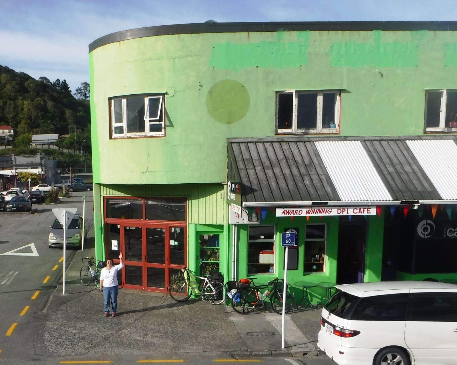
At the forty km mark we pulled into Graymouth and met up with Agnes and Amy for coffee. Graymouth is a pretty vibrant looking town and probably the biggest on the west coast.   We had grabbed coffee in a place called DP1 which was a funky little coffee joint right on the water front.

After coffee the next stop was at the 82 kms mark up at Paparoa National Park/Pancake Rock.   The Pancake rock formations are this stratified limestone formation which out crops right on the ocean.  The ocean has craved them into these weird shaped stacks of pancakes. The entire area is probably only a few acres as just down the road the limestone is big blocky sections.  The views from the cliff overlooking the ocean were spectacular.  There are places where if the tide is right the wave surges through blow holes and is quite spectacular.  However the tide wasn’t right so we didn’t see the blow holes.

As we were packing up and getting ready to roll out of the parking lot Lockie from my Italy bike tour walks up.  What a shock seeing someone you have ridden with 4 years ago when you are thousands of miles away from home.

It was already 3:15 Pm and we still had 30 kms to go and close to a 900 meters of climb yet to do and while we had gotten away 8:15 Am we had stopped for coffee, stopped for lunch and the stopped to visit the nature park and do the big walk.  The first of the big climbs started right away. It was a huge grind up and over this big row of hills which formed part of this nature preserve.  There was only one thing to do, and that was put it in low gear and spin your way up.  It took a lot of grinding and we were only going 8-12 km/hr but with a little perseverance we made it.  That is the good thing about kilometers is that they knock off pretty fast.

The town of Charleston is only 250 people and the restaurant is closed today so we had to cook in the hotel room.  Agnes and Amy stopped and bought some premade kababs which I cooked on a community grill.  They turned out excellent.  Agnes and Amy added some potatoes and green beans and we had a feast.   

For the detail minded here is a link the actual route: https://goo.gl/maps/bGZ9DUHemHq

What a great day. No rain, 112 kms of unbelievable scenery, fabulous weather, great supper.   It just doesn’t get any better.  


Terry 

Monday, March 21, 2016

March 21, 2016 Rest day Hokitika


It was a rest day today so we didn’t have to jump out of bed early and pull on all the riding gear.  Make decisions on too many clothes, not enough, leg warmers, arm warmers, vest or no, vest rain coat or not etc. etc.  Instead I rolled over and turned the electric bed warmer up.  Bed warmers here in New Zealand are the real deal.  They don’t have any central heating so they have these electric mattress heating pads which are so nice to cuddle into. 

Tom had volunteered to make breakfast so he cooked bacon and scrambled eggs for breakfast which were absolutely wonderful.  After several cups of coffee and lots of toast we headed downtown to the jade shop.

Agnes wanted to find a pair of ear rings to match her jade piece she bought the other day. Tom and Amy also wanted to buy some jade pieces.  Mark the jade carver was in working today and gave us a tour of his shop.  It was very interesting seeing all the different saws, polishers and carving tools he uses to make the jewelry.   Most of the tools are very basic but it takes a lot of skill and artistic ability to make such beautiful jewelry.  Looking at the raw jade was also very interesting as it looks like ordinary rocks before it is worked. It is really nice to find some genuine articles and not something made in China.

After the jade shop Agnes and Amy headed off to the hair dresser and Tom, Jos and I went to the local museum.  There is a lot of history here in Hokitika as it was the epicenter of the New Zealand gold rush of the 1860-1880’s.  There were pictures of hundreds of sailing ships in the harbor unloading men and equipment.  After the gold rush was over the industry turned to Whitebait (Whitebait is a tiny little fish like a sardine) fishing, logging and finally agriculture.  Agriculture and tourism are now the main industries. 

I cooked chicken on the grill for supper and after supper the neighbor cat jumped on the grill to clean it off.  

Tomorrow we are riding up to Charleston which is on the coast.  I don’t think there is much there as the motel where we are staying, phoned to say the only café in town will be closed for the day. 


Terry